Chicago's Most Popular Bikeshare Routes
The following are my justifications and interpretations of my map:
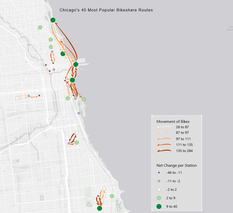
- Seeing that the flows of this map are the most important aspect of this visualization, I chose to put them on the highest layer of symbology.
The orange color of them contrasts with the green nodes and the dark background.
For the style, I used the Curved Half Arrow so the direction of the flow was easily understood.
The nodes are a diverging color scheme from purple to green. This makes it easy see which bikeshare rack had a net loss or gain. Both colors are distinguishable from the flow and background choropleth colors.
-
Patterns in this dataset are very apparent. It seems most people are using bikes to travel to and from Navy Pier and other tourist locations on the coast.
Outside of the common tourist destinations, most bikes are used to travel North to South.
Maybe Chicago's public transit primarily moves East/West and bikes are resident's form of transportation post Bus or L-Rail ride.
Aside from the directionality of the flows, most of them are concentrated on the North side of Chicago. From experience, this is where most of the toursity areas are in the city.