Angelina Evans
Geovisualization Portfolio
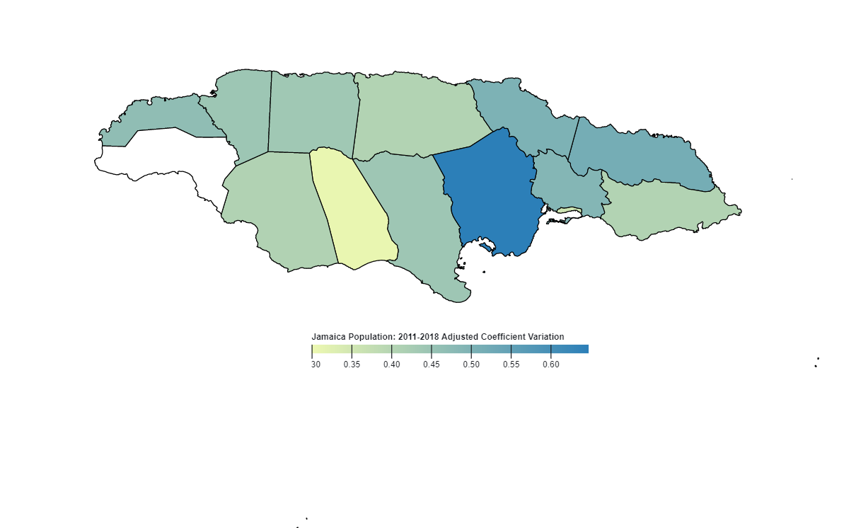
Jamaica Population
This map shows the coefficient variation of Jamaica's population for 2011-2018.
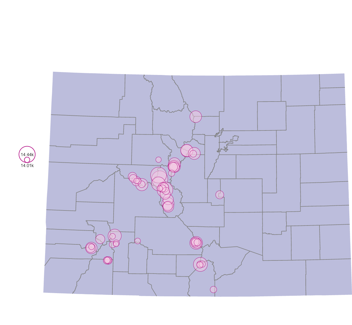
Colorado Fourteeners
See the names and elevation of the 58 Colorado Fourteeners.
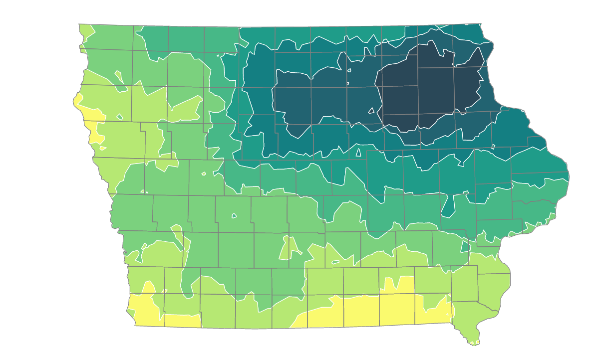
Iowa Precipitation
This isarithmic map shows the average yearly precipitation in Iowa.
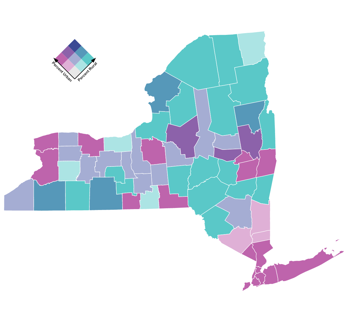
New York Rural & Urban Population
Bivariate choropleth map of the 62 counties in New York. Data from 2000 census.
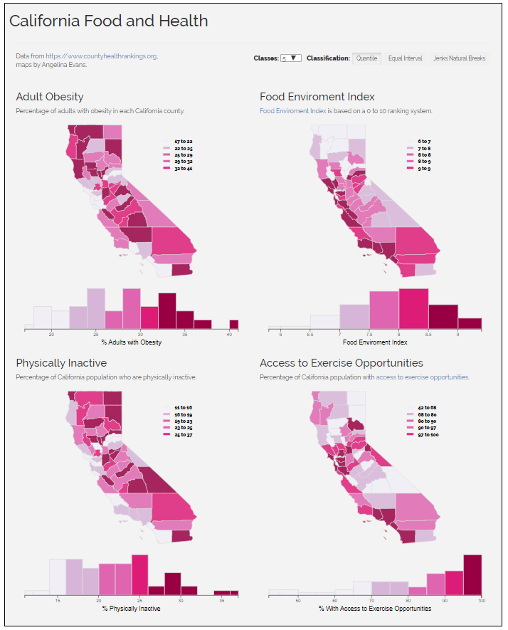
California Food and Health
Obesity Rates, Food Enviroment Index, Physically Inactive Rates, and Excersise Opportunity Access Rates of California counties for the year 2020.
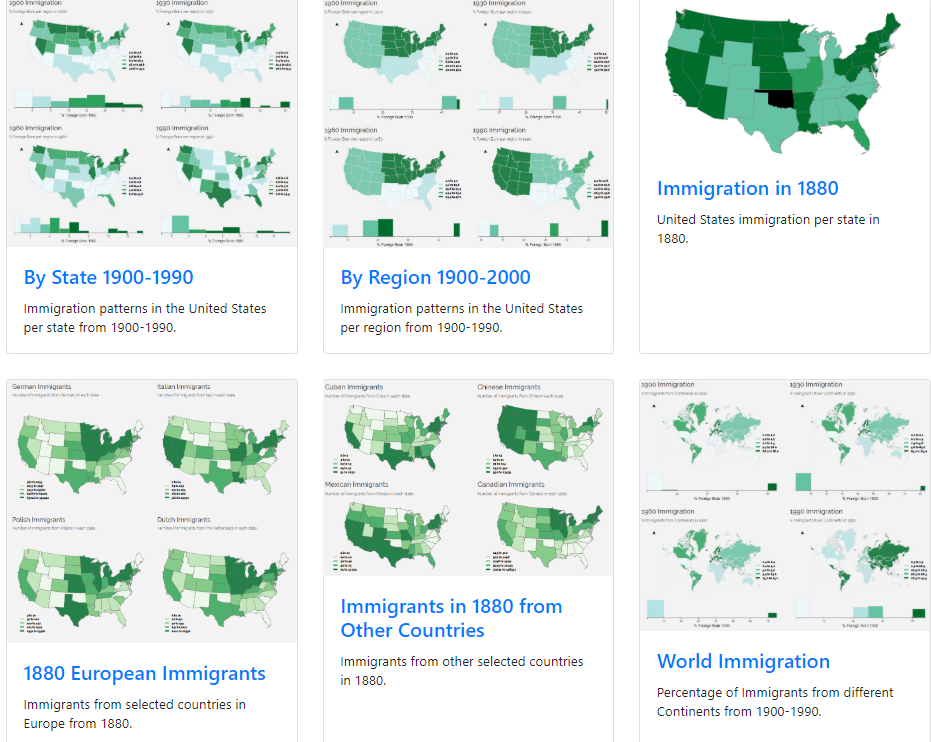
Final Project Page
Explore United States immigration visualizations created by Angelina Evans and Claire Fienup.